Perth’s Sun-Drenched Wednesday: Clear Skies Prevail as Cyclone Narelle Looms Offshore
Enjoy the Sunshine: Perth’s Mid-Week Forecast
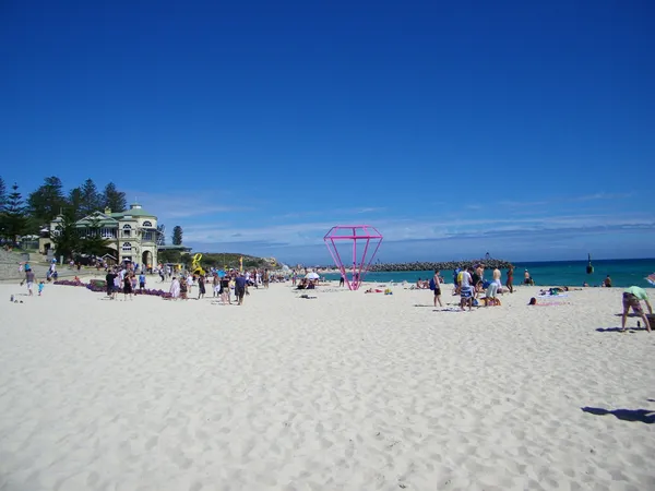
Residents across the Perth metropolitan area can look forward to a beautiful autumn day this Wednesday, March 25, 2026. The morning started with a crisp 17°C, and temperatures are expected to climb steadily throughout the day, reaching a pleasant maximum range of 27°C to 29°C. With humidity sitting around 52%, the air will feel comfortable and dry, making it an ideal day for outdoor activities before the weather pattern shifts significantly later in the week.
Diurnal Breakdown: From Dawn to Dusk
- Morning: The day began with clear, bright blue skies and light easterly winds. Temperatures will hover around 18°C by mid-morning, providing a fresh and energetic start for commuters and school runs.
- Afternoon: The heat will peak in the early afternoon, reaching the high twenties. The UV index is forecast to hit a 'Very High' level of 9, so sun protection—including hats, sunscreen, and shade—is strongly recommended for anyone outdoors between 10:00 AM and 4:00 PM.
- Evening: As the sun sets, the sky will remain largely clear, though some high-level cloud cover may begin to drift in from the north. Temperatures are expected to dip back to a comfortable 20°C by 8:00 PM, perfect for alfresco dining.
- Overnight: Conditions will remain mild with a low of 18°C. While the daylight hours remain dry, there is a developing 20% chance of isolated showers late tonight as atmospheric pressure begins to drop across the West Coast.
Special Alert: Tropical Cyclone Narelle Tracking South
While today offers a sunny reprieve, the Bureau of Meteorology and emergency services are keeping a close watch on Tropical Cyclone Narelle. Currently tracking down the Western Australian coastline, the system is proving to be a rare meteorological event. It has already moved across Queensland and the Northern Territory, making it the first cyclone since 2005 to affect all three of Australia's tropical regions in a single event.
Senior meteorologist Angus Hines has highlighted the unique nature of this system. While Perth is currently basking in clear weather, modeling suggests that the cyclone’s influence could bring significant rainfall and gale-force winds to the metropolitan area by the coming weekend. Forecasters warn that up to 100 millimeters of rain is possible in the coastal stretch between Geraldton and Perth if the system maintains its southerly trajectory. Residents are encouraged to use today’s calm conditions to secure loose outdoor items and review their home emergency plans.
Summary for Commuters and Travelers
Visibility remains excellent for all regional travel today, with no immediate wind or rain warnings in effect for the Perth metro area. Winds will stay light to moderate from the east/southeast, with a refreshing sea breeze expected to arrive late in the afternoon. However, with the 'calm before the storm' currently in effect, today is the best time for preparation before the potential weekend impact of Cyclone Narelle.

Elvis Tributes and French Cinema: Perth’s Best Cultural Events Today

Aussie Rock and Airport Ambitions: Your Friday Morning Briefing

Morning Commute: Smooth Runs on Major Rail Lines Despite Local Bus and South Perth Disruptions